
ICID Secretary Generals Visit to THAICID
and Irrigation Projects in Thailand
Wednesday 22 December 2010
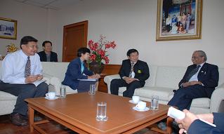
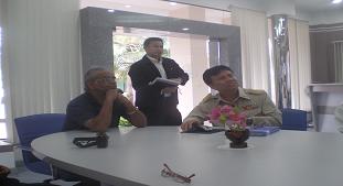
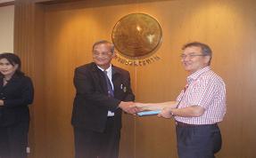
![]() Mr. Gopalakrishnan, Secretary General of ICID made a courtesy call to and discussion with Mr. Chalit Damrongsak, Director General of Royal Irrigation Department, Thailand and President of THAICID at the department together with Mr. Chaiwat Preechawit (Vice President of ICID) and staff of THAICID secretariat office.
Mr. Gopalakrishnan, Secretary General of ICID made a courtesy call to and discussion with Mr. Chalit Damrongsak, Director General of Royal Irrigation Department, Thailand and President of THAICID at the department together with Mr. Chaiwat Preechawit (Vice President of ICID) and staff of THAICID secretariat office.
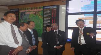
![]() THAICID President and ICID Secretary General at the operation room of Water Watch and Monitoring System for Warning Center, Royal Irrigation Department, Thailand. Secretary General of ICID expressed his strong impression of the development of Thailands irrigation technologies.
THAICID President and ICID Secretary General at the operation room of Water Watch and Monitoring System for Warning Center, Royal Irrigation Department, Thailand. Secretary General of ICID expressed his strong impression of the development of Thailands irrigation technologies.
Sunday 20 December 2010
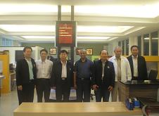
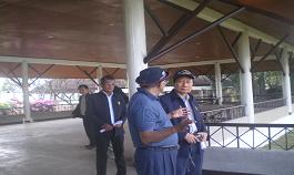
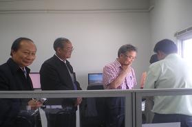
![]() Mr. Winai Phongchinda, Director of Regional Irrigation Office 1 of Royal Irrigation Department and other RIO 1 staff welcomed Secretary General of ICID and Mr. Chaiwat Preechawit to the office and briefed them on the office responsibilities.
Mr. Winai Phongchinda, Director of Regional Irrigation Office 1 of Royal Irrigation Department and other RIO 1 staff welcomed Secretary General of ICID and Mr. Chaiwat Preechawit to the office and briefed them on the office responsibilities.
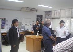
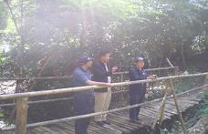
The Director then lead them to observe the work of Hydrology and Water Management Center for Upper Northern Region where Mr. Thada Sukhapunnaphan, Chief of the Center welcomed and briefed the visitors of flood disaster conditions and warning system of the region. Secretary General of ICID showed his interest to the center work.
Thrusday 23 December 2010
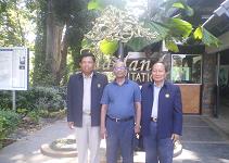
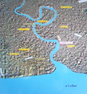
![]() Mr.Chainarin Phanphinyaphon, Director of Regional Irrigation Office 11 welcomed Prof. Kim, Tai-Choel (Executive of Korean National Committee on Irrigation and Drainage or KCID), Mr. Chaiwat Preechawit, Vice President of ICID and staff of THAICID secretariat Office on their visit to Khlong Lad Pho Flood Alleviating Regulator Project and Suvarnabhumi Airport Drainage Project.
Mr.Chainarin Phanphinyaphon, Director of Regional Irrigation Office 11 welcomed Prof. Kim, Tai-Choel (Executive of Korean National Committee on Irrigation and Drainage or KCID), Mr. Chaiwat Preechawit, Vice President of ICID and staff of THAICID secretariat Office on their visit to Khlong Lad Pho Flood Alleviating Regulator Project and Suvarnabhumi Airport Drainage Project.
Initiated by His Majesty the King
On the 7th November B.E. 2538 (1995) at the Dusti Maha Prasat Throne Hall of the Grand Palace, HIS MAJESTY KING BHUMIBOL ADULYADEJ of Thailand conveyed an initiative to Mr. Ruruang Chulajata, Director General of the Royal Irrigation Department, Pol. Gen. Chamlong Iamchaengphant, Assistant Director General of Royal Thai Police and Mr. Chari Tulayanond, Former Director General of the Royal Irrigation Department and a member of the Chaipattana Foundation that the concerned agencies ,namely, the Royal Irrigation Department, Samut Prakan Province, Department of Highways, Hydrographic Department of the Royal Thai Navy should cooperatively undertake the project planning of the Klong Lat Pho Dredging and Improvement Project together with the construction of appropriate structures. The project is aimed at accelerating the drainage of excess flood of the Chao Phraya River in its meander belt section named Bang Krachao of 18 kilometer length in Samut Prakan Province.
There, to shorten the distance of the river flow and accelerate the flow to the Gulf of Siam, an existing shortcut canal of 600 meter length shall be dredged and widened from its 15 meter width to 65 meter width. By this mean, flood over Bangkok area will be alleviated.
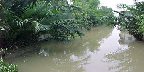
Original Conditions of the Lat Pho Canal
The Lat Pho Canal was originally a small and shallow canal of 10-15 meter width and 1-2 meter depth. The canal was excavated to shortcut the river at the Bang Kracho meander neck in Song Khanong Sub-district, Phra Pradaeng District, Samut Prakan Province .
Canal Conditions Prior to Improvement
Canal Features after the Construction
- 65-meter canal width upstream of the gate and 66-meter width downstream
- 7.00- meter canal depth
- 600-meter canal length
- 4 flood gates of 14-meter width and 9.55-meter height
Water Management
The flow of Chao Phraya River in this section is under the sea tidal effect, especially at the section from the river mouth up to Bangsai District, Phra Nakhon Si Ayutthaya Province. At the river mouth, the sea tide measured at Pom Phrajulachomklao tide gauge station can be characterized into 2 patterns: first, rise and fall once a day with approx. 8-10 hr. rise and 14-16 hour fall and second, rise and fall twice a day with approx. 5-6 hr. rise and 6-7 hr. fall). Under this difficult condition, flood drainage can be done only in tide fall duration. However, during flood peak season, the river flow from the North is so tremendous that the flood can be drained to the sea even in high tide duration, which enables 24 hour gate opening.
Criteria for Draining Flood
- When river water is released through the Chao Phrya Barrage Upstream at 1,000 cubic meters per second
- The mean velocity through the gate can be controlled to be less than 1 meter/second
- Discharge through the gate is less than 500 cubic meter/second
Project Benefits
- efficiency increase of drainage of the Chao Phraya river by 10-15% without damages to the Phra Pradaeng district and passing by vessels
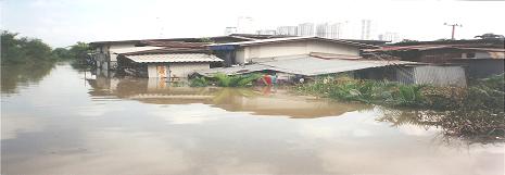
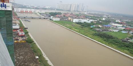
Phra Pradaeng Area Prior to the Project Completion
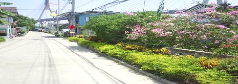
Phra Pradaeng Area After the Project Completion
Performance of the Project in Year 2006, 2007, 2008, 2009
| Year 2006 | (million m3) 2007 | (million m3) 2008 |
(million m3) 2009 | (million m3) 2010 | (million m3) |
| August | - | - | 260 (18 Aug. 10) |
||
| September | Operation Trial | 323 (2 Sept.07) |
313 (15 Sept.08) | 37 (29 Sept.09) | 711 |
| October | 1,009 | 510 | 539 | 796 | 897 |
| November | 930 (30 Nov.06) | 82 (7 Nov.07) |
593 (27 Nov.08) | 42 (2 Nov.09) | 946.06 (26 Nov.10) |
| Total | 1,939 | 915 | 1,445 | 875 | 2814.06 |
Day of Drainage Commencement
Day of Drainage Finish
Graph Comparing Cho Phraya River Water Level of Year 2002 and Year 2006
Measured on the date 11 Oct. 02 and 30 Oct 06
At the River Flow Rate Measured at Bang Sai District at 3,200 cubic meter/second
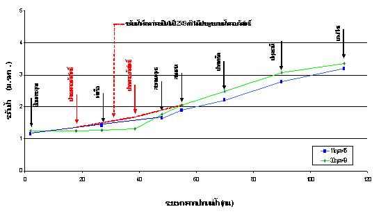
The above graph compared the Cho Phraya River water level of year 2002 and 2006 on 11 Oct. 02 and 30 Oct 06 at the river flow rate measured at Bang Sai District at 3,200 cubic meter/second. Though the flood volume of both year was almost the same, the graph reveals that due to the Lat Pho gate operation, water level of the river in 2006 is much lower especially near the Lat Pho Project where it is lowered by 35 centimeters.